ParcellQ project is a web-based real estate intelligence platform that provides comprehensive information necessary for understanding real estate across a U.S. state. The system consolidates considerable amounts of public and third-party data to provide information on real estate, land, environmental risks, community analysis, and property value estimations. ParcellQ platform aims to assist in real estate decision-making.
Property Search & Appraiser Software
A data-driven property search software for deep property analysis, valuation, and reporting, aggregating public, geographic, and environmental data to support real estate professionals and investors.
Industry
Real Estate
Team Size
8 Members
Country
🇺🇸 United States
ParcellQ Overview
Tech-Stack
 AWS
AWS MySQL
MySQL Nest.js
 PostgreSQL
 React
ReactEngagement Model
Full Product Development
Highly recommend them. I'm a startup founder, and looking for a trusted and reliable partner in development is hard. I'm fortunate enough to have partnered with them and have no hesitation in recommending them.

Nick
Founder

Challenges of Property Records
The main challenge was to aggregate and standardize massive volumes of unstructured data from public and external sources. The integration of property records, geographical boundaries, risks, zoning laws, and neighborhood statistics into one uniform system was the other challenge. Another challenge was to present this complexity through a UI that would stay clear, fast, and easy to use for people without technical knowledge.
Solution We Provided
The web development process began with discovery sessions, where the team interviewed stakeholders, defined key objectives and user types, and developed clear requirements for the future property appraiser application. We developed the UI/UX design of this application from scratch, starting from the UX flows, interaction scenarios, and modular screen structures to support complex property records while keeping the interface easy to use. In the early stages, a large number of interface options were created, which significantly reduced ambiguity during development and accelerated implementation.
After the web design stage, we started on implementing it using a modern, scalable technology stack. The frontend was developed with React along with a custom server rendering solution to achieve rapid loading of web pages and a responsive real estate property search software experience, even with large data sets, as well as interactive maps.
To ensure fast backend performance, we used Nest.js. This solution provides a clear, modular structure and a stable API level for data processing and aggregating public property records, tax records, and external datasets. The engineering team focused particularly on handling complex connections between data, spatio-temporal queries, and high-volume read operations. MySQL and PostgreSQL were used together to separate transactional data from geographic information, forming the foundation of a robust property database software.
ParcellQ platform was deployed on AWS, and Amazon S3 we used to host documents, images, and generated reports. This architecture allowed the system to remain adaptable, scalable, and ready for future scaling and increasing user load.
ParcellQ Features
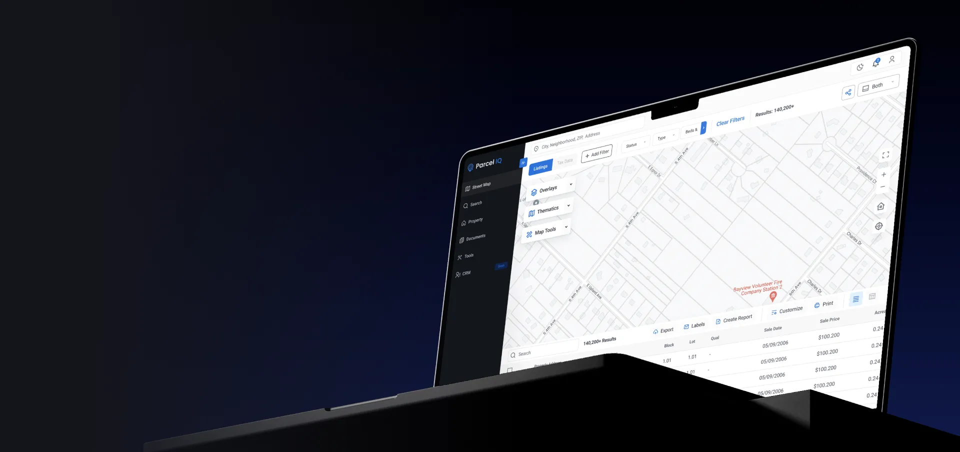
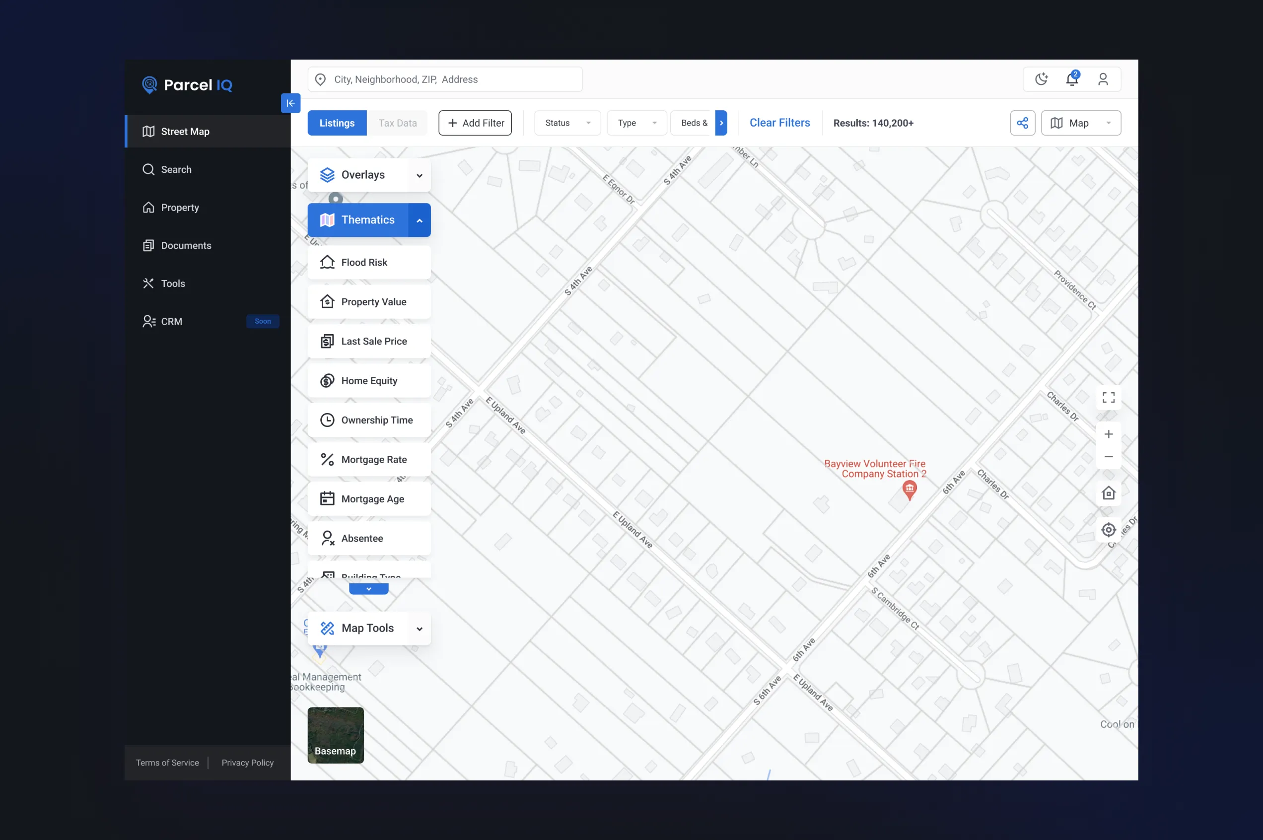
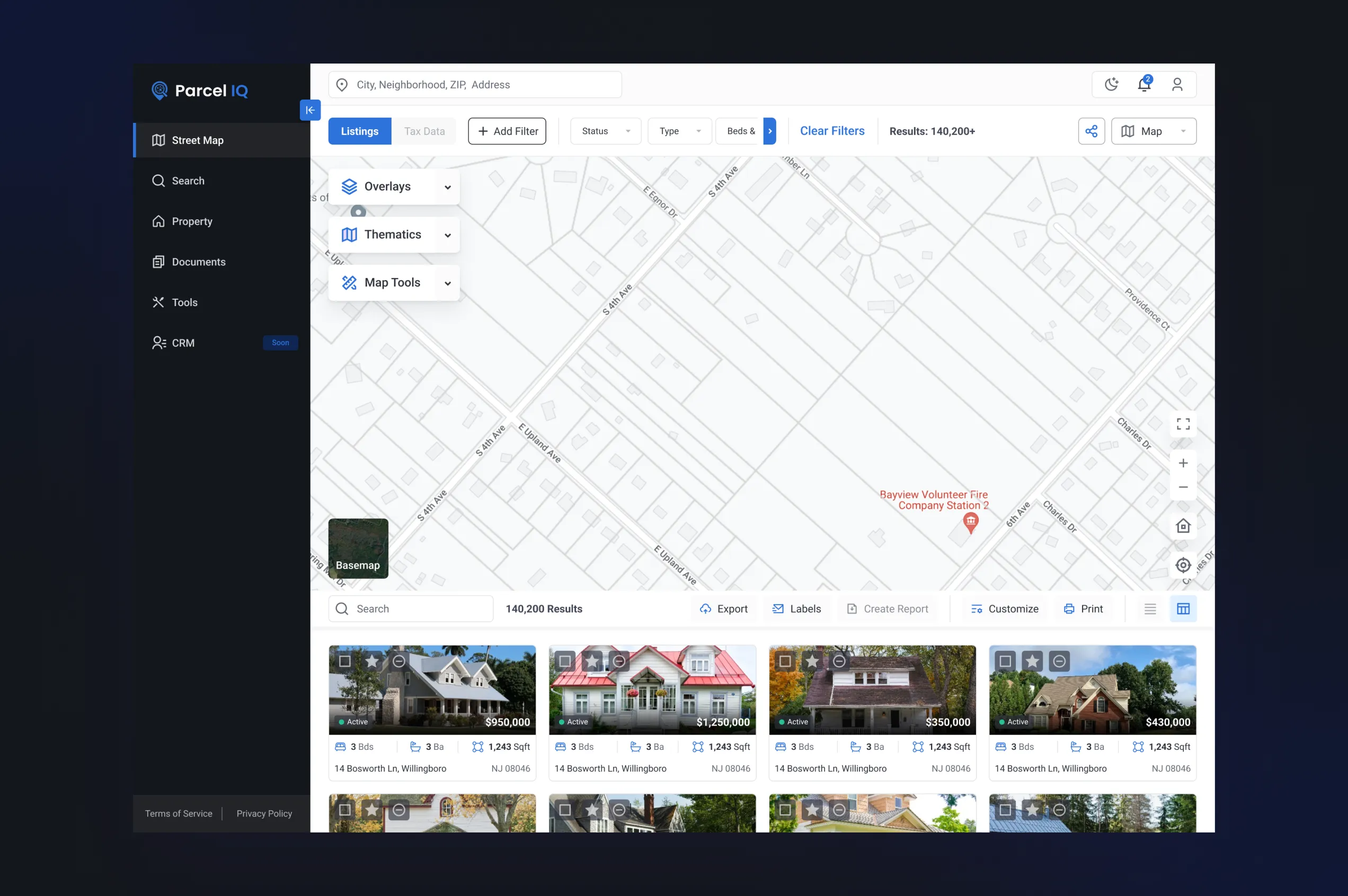
Advanced Property Search
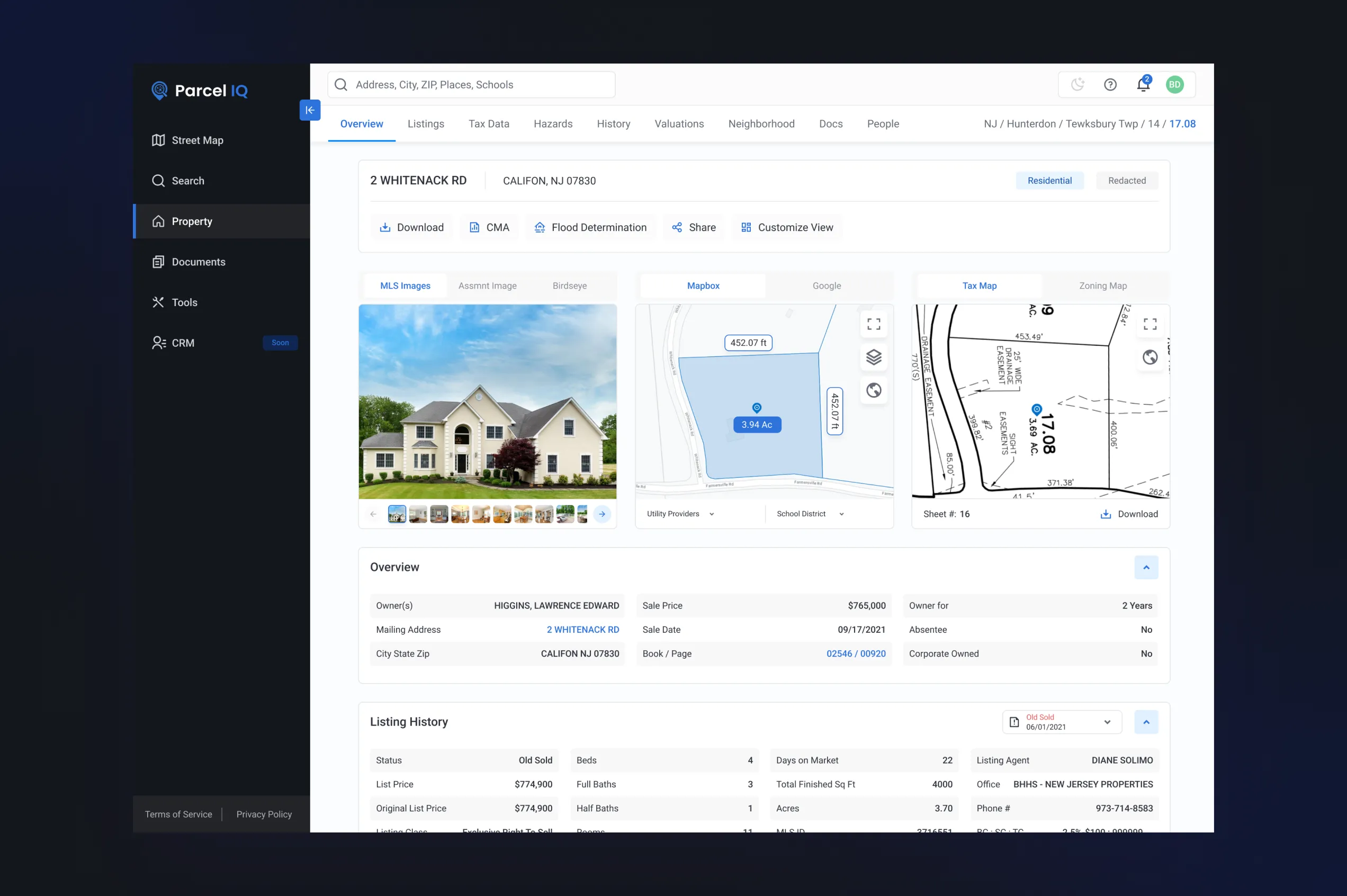
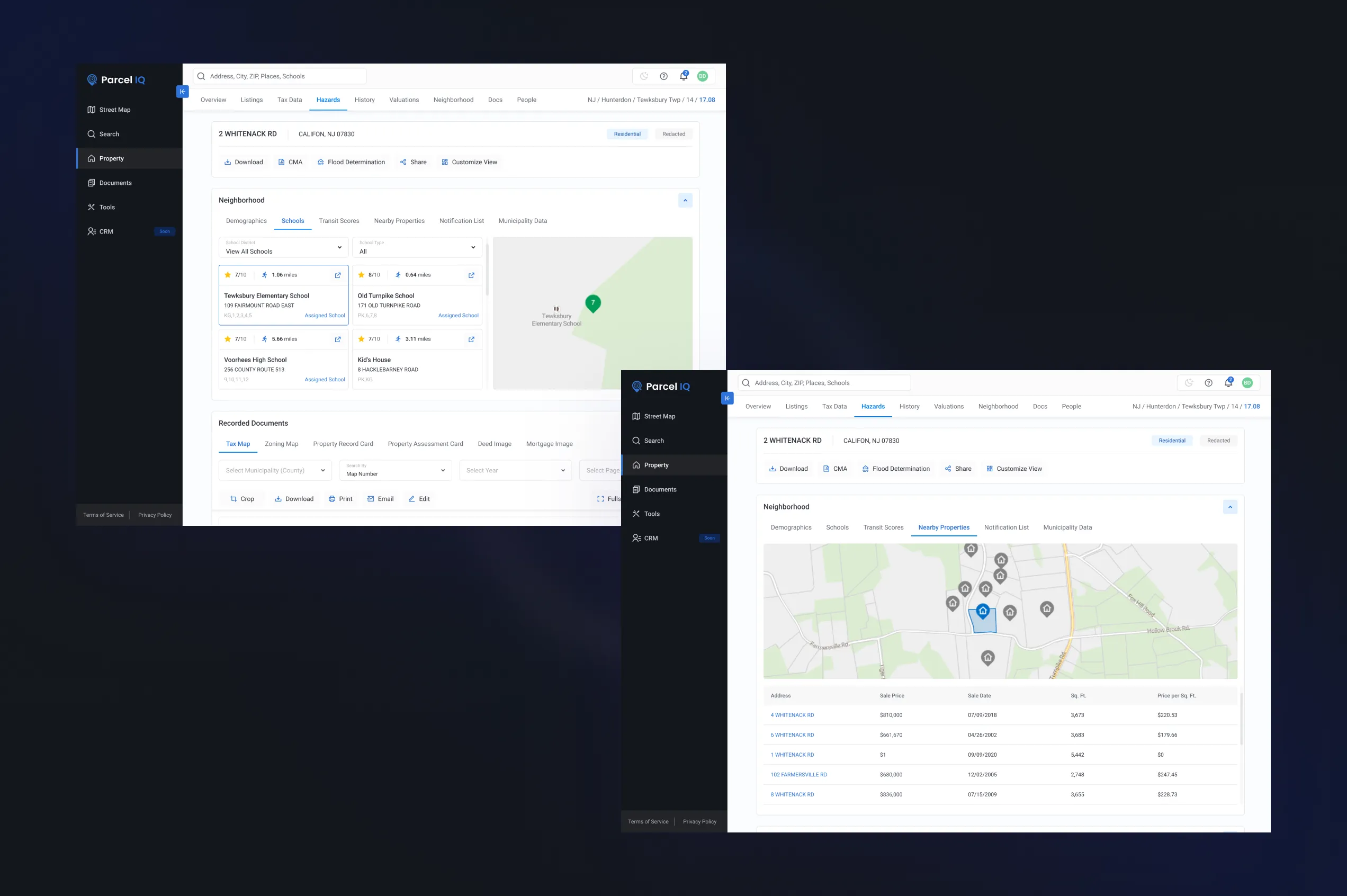
ParcellQ platform provides advanced property search capabilities that allow users to explore property records by address, parcel number, municipality, or defined geographic areas. This functionality makes the system effective as both a property search software and a daily research tool for agents, investors, and appraisers.
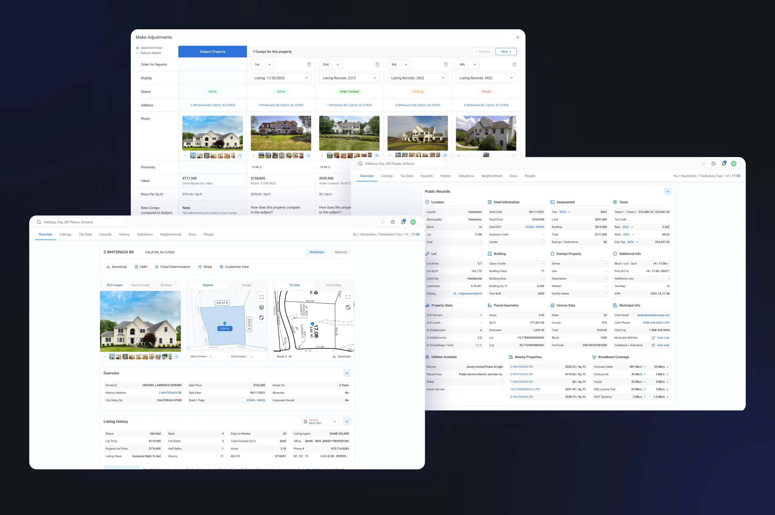
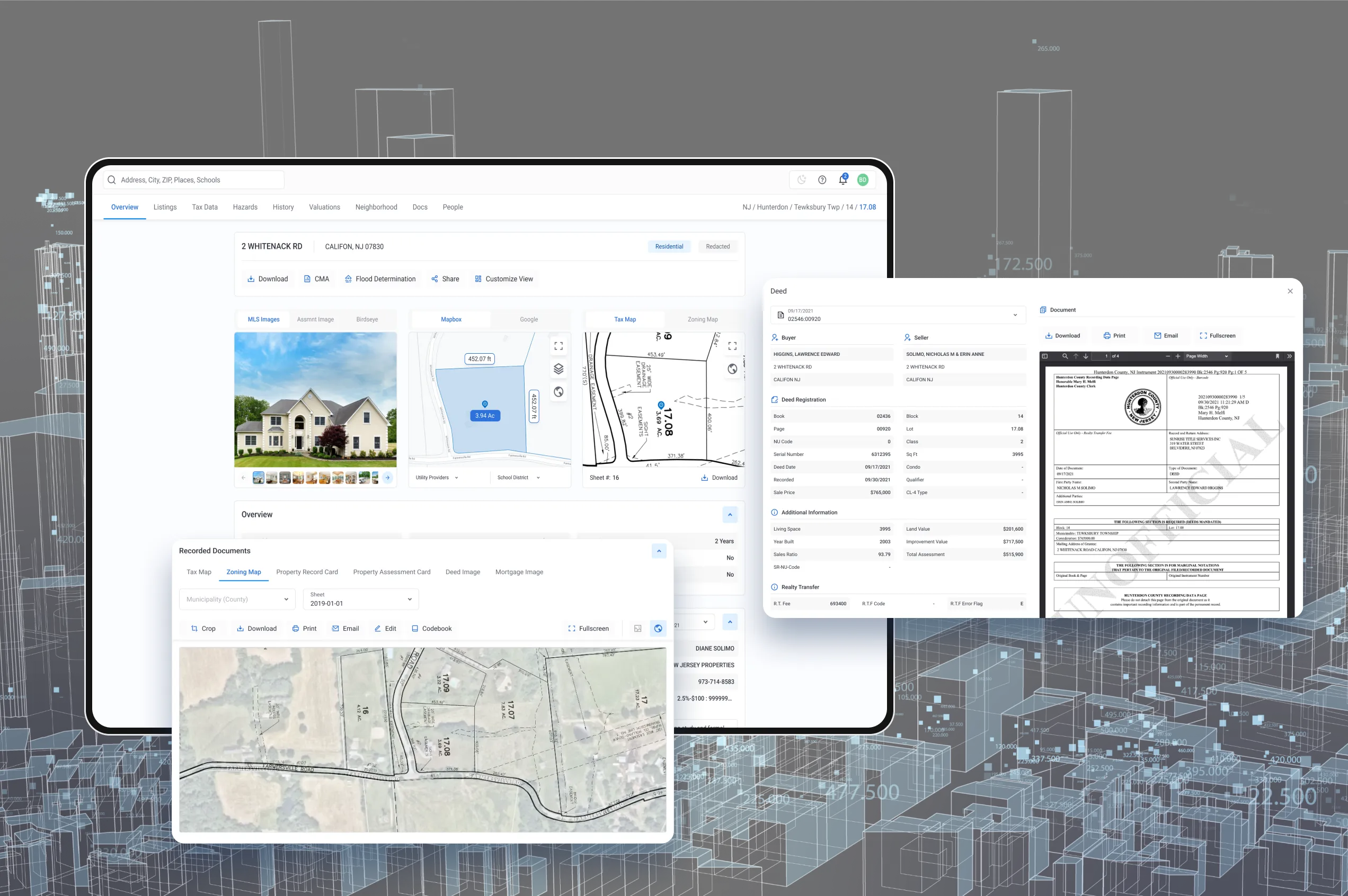
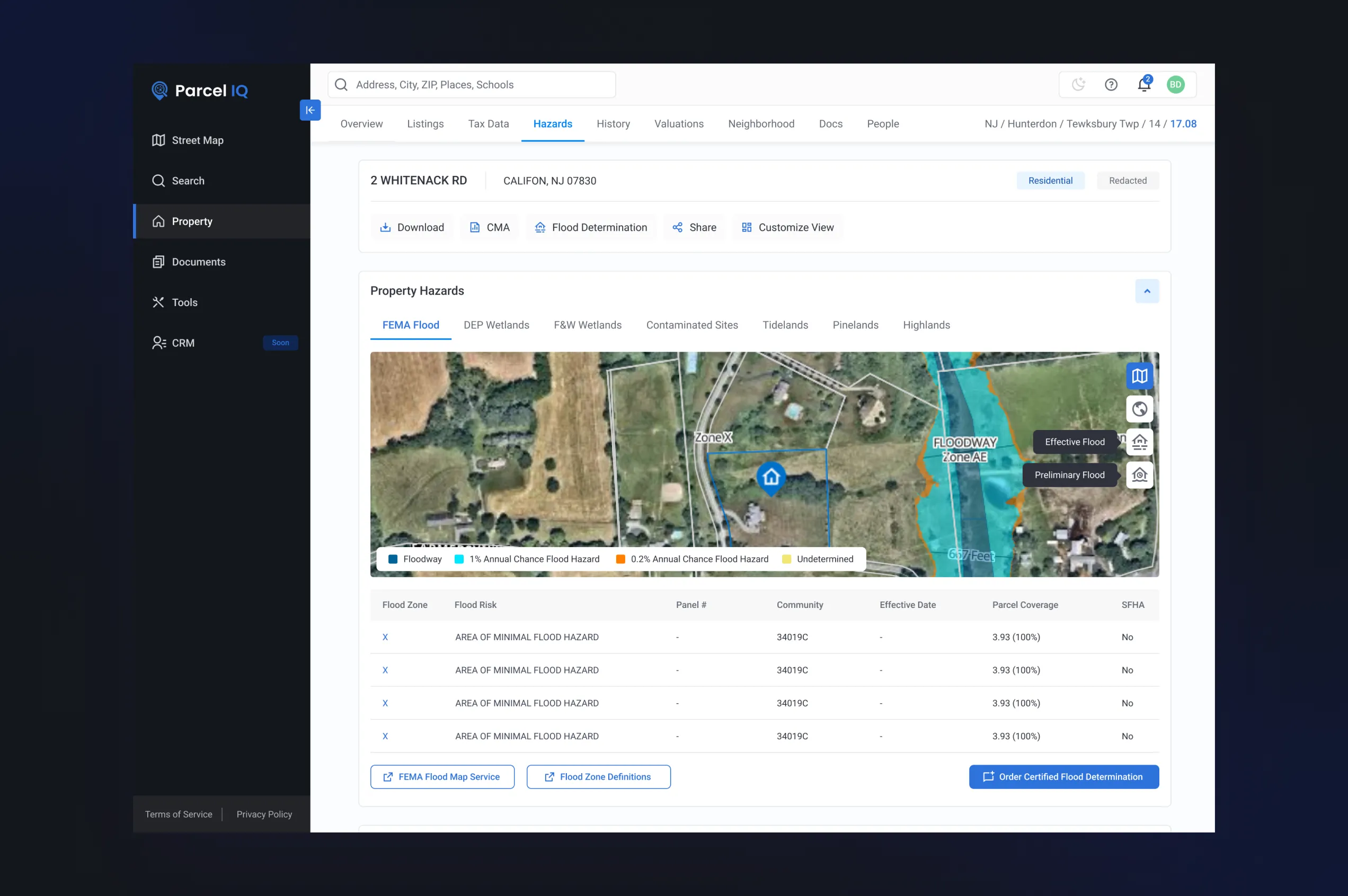
All collected property records from many public and external sources create a structured property report that provides the most detailed information about the property’s history, tax records, weather, and geographical conditions that may affect market value, infrastructure located around the property, and other information.
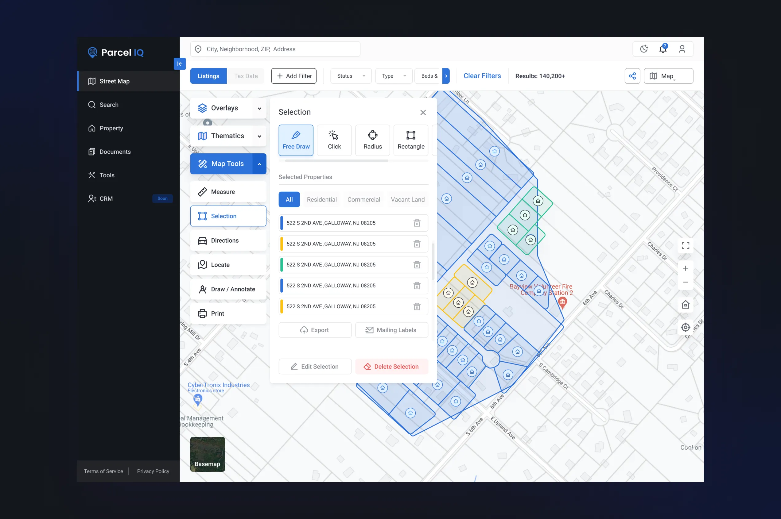
Interactive Maps
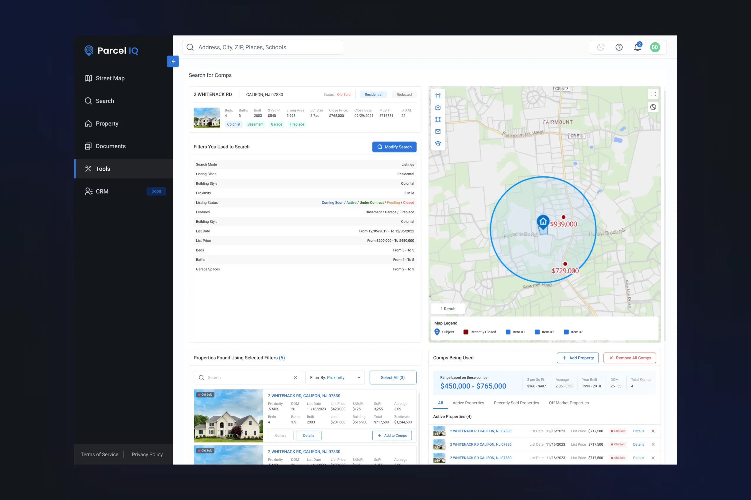
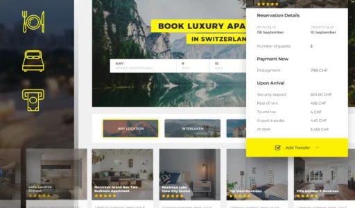
One of the key features is the interactive map engine. It allows users to display various layers of data, including the boundaries, flood zones, aerial imagery, and infrastructure maps. This solution helps to explore property risks and opportunities. Additionally, the user can also employ the robust filters to filter the properties based on price, status, type, and various other criteria.
External Insights
To enable in-depth analysis of public property records, the system offers additional information about the property and its context. This information can relate to nearby educational institutions such as schools and kindergartens, infrastructure, properties around the area for sale, and so on.
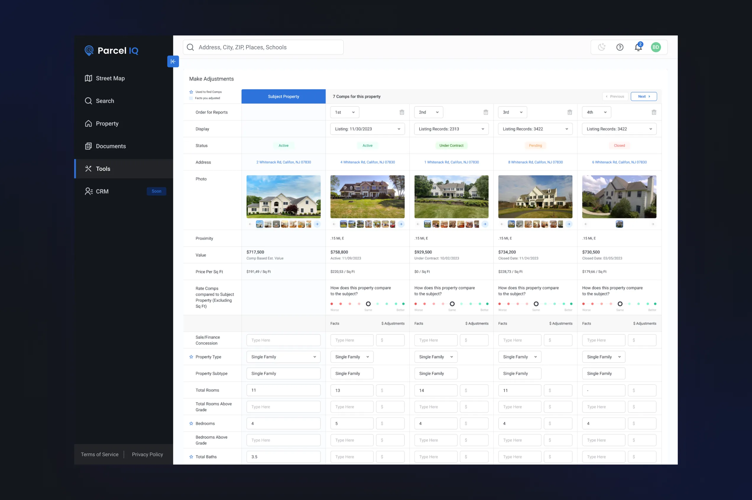
Comparative Valuation
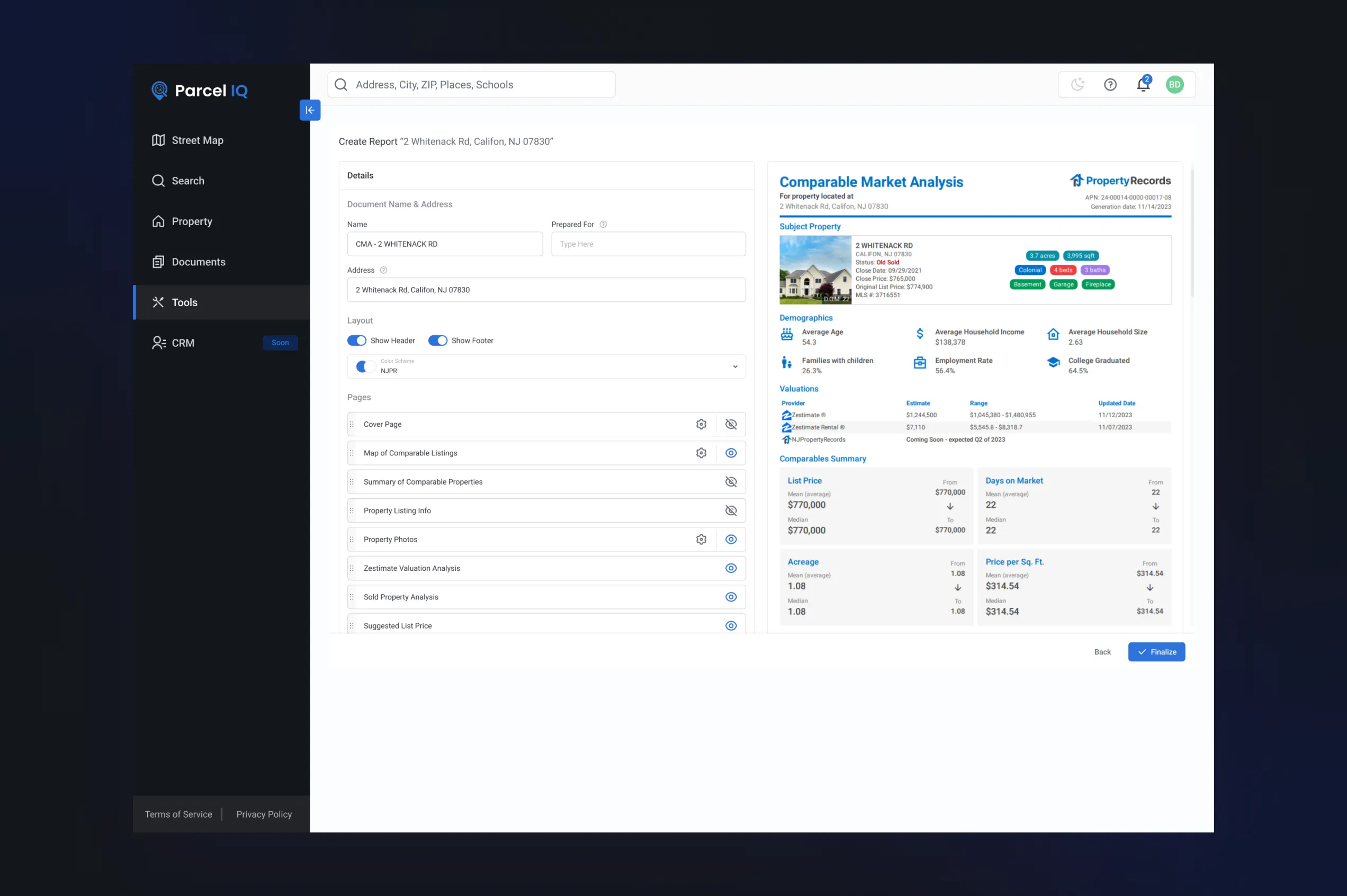
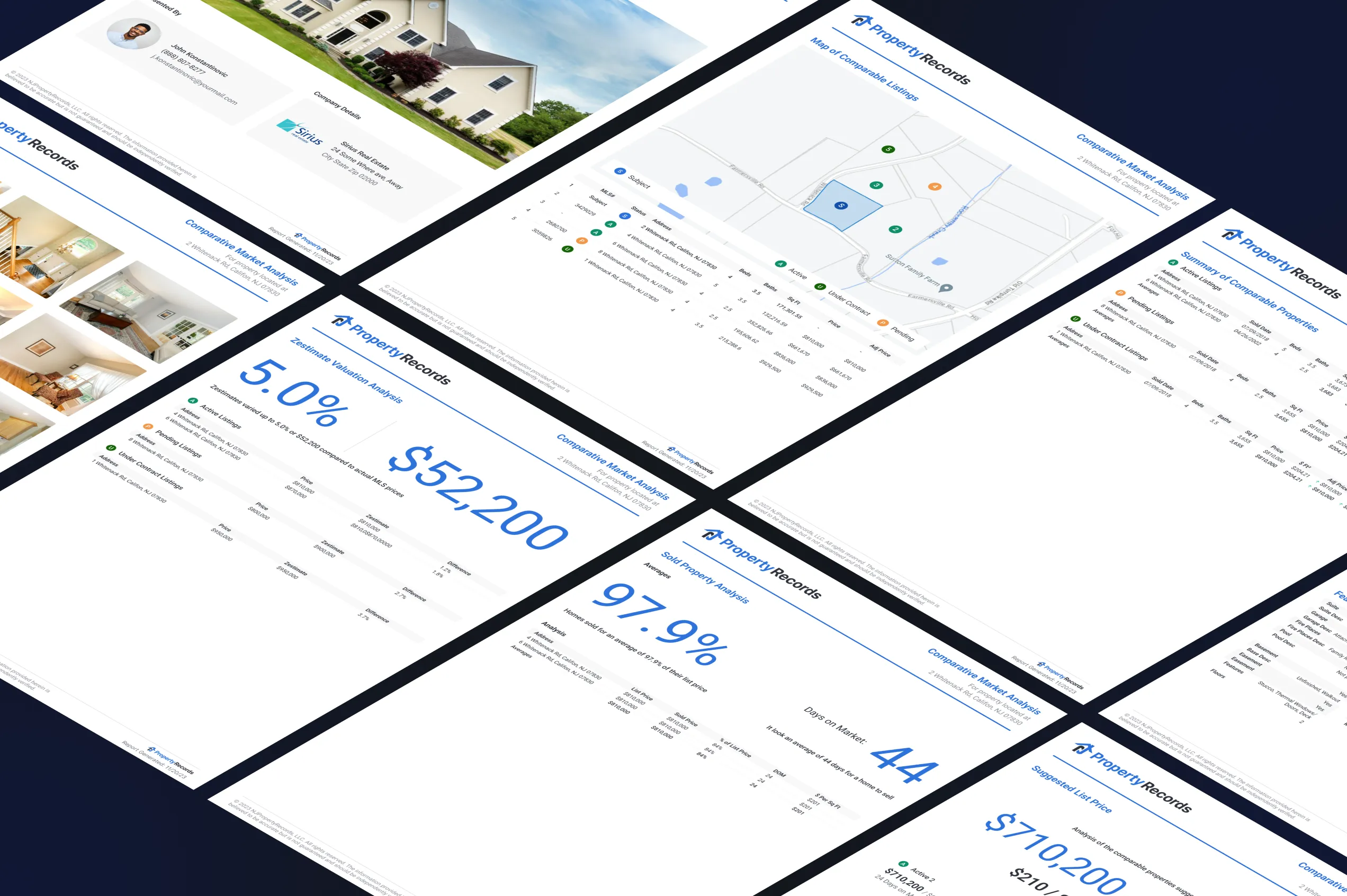
We have developed tools for comparative analysis, enabling users to select various properties and compare them based on market trends in their surrounding locations. By using different variables, the property title search software solution helps in determining fair market values and making correct pricing decisions. Data extracted from the comparative benchmarking can be converted into client-ready property reports.
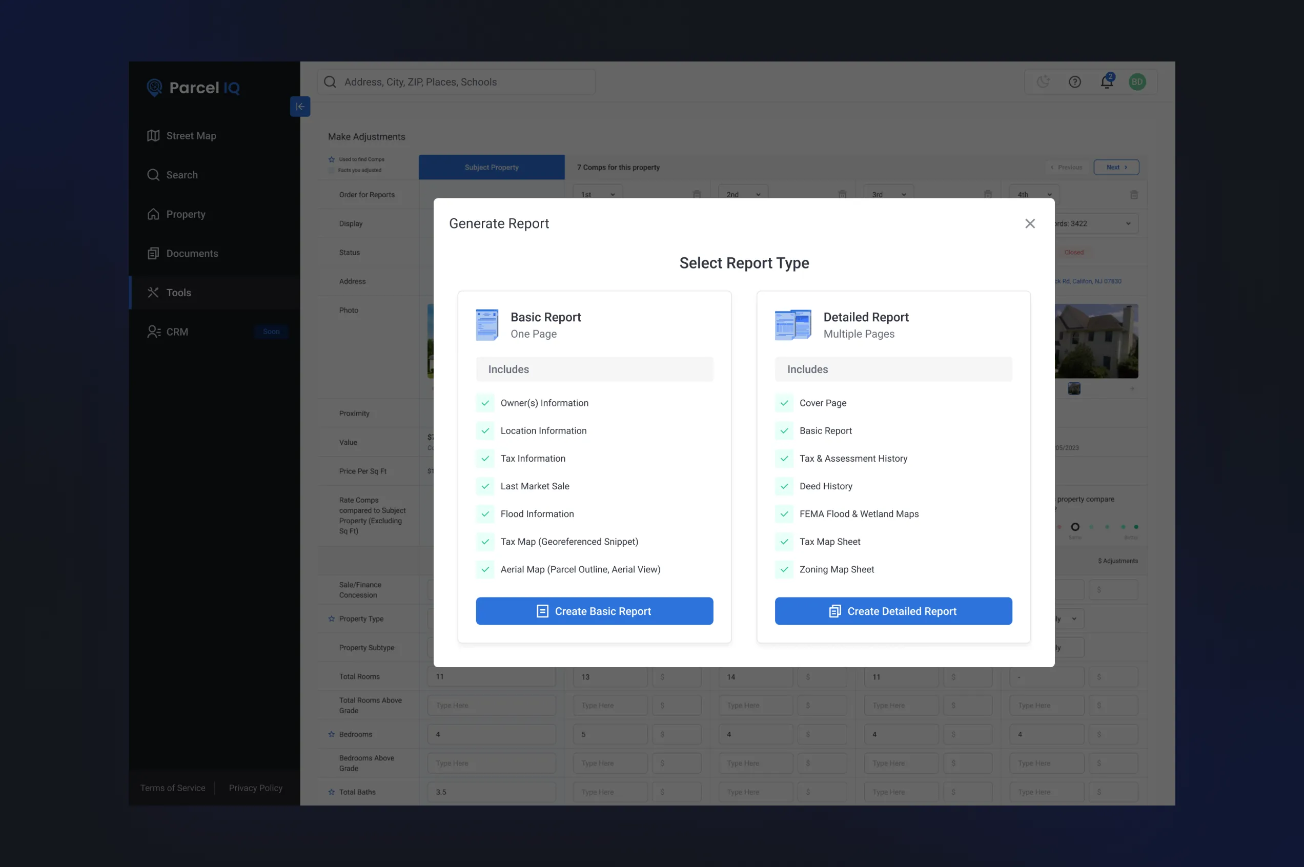
Reports
Another significant aspect was reporting. Users can create detailed PDF reports that include maps, charts, property data and comparative analytics. Users can easy to customize the reports, export and share with clients, investors or internal team.
What's the Result?
This tool for real estate agents was developed as a highly scalable and data-rich tool for property analysis and valuation. It enables users to uncover deep property insights, carry out comparative analysis, map risks using interactive features, and create professional reports—all in one real estate decision-making platform. The system was developed with future scaling and CRM module integration in mind.
Do you have a similar real estate challenges? Let's discuss!
Schedule a free call with a Dinamicka business development manager to get a clear vision of your custom software project.
More Cases
Dinamicka Development is proud of the results achieved through partnerships with various companies. So, now, we are happy to share the successful projects that we have implemented. Each of these cases demonstrates our ability to tailor our approach to clients' unique requirements and provide custom mobile development services that meet their expectations and needs.
AI-Powered Real Estate Development Software
eCommerce Analytics Platform
Luxury Hotel Booking Website